Baton Rouge
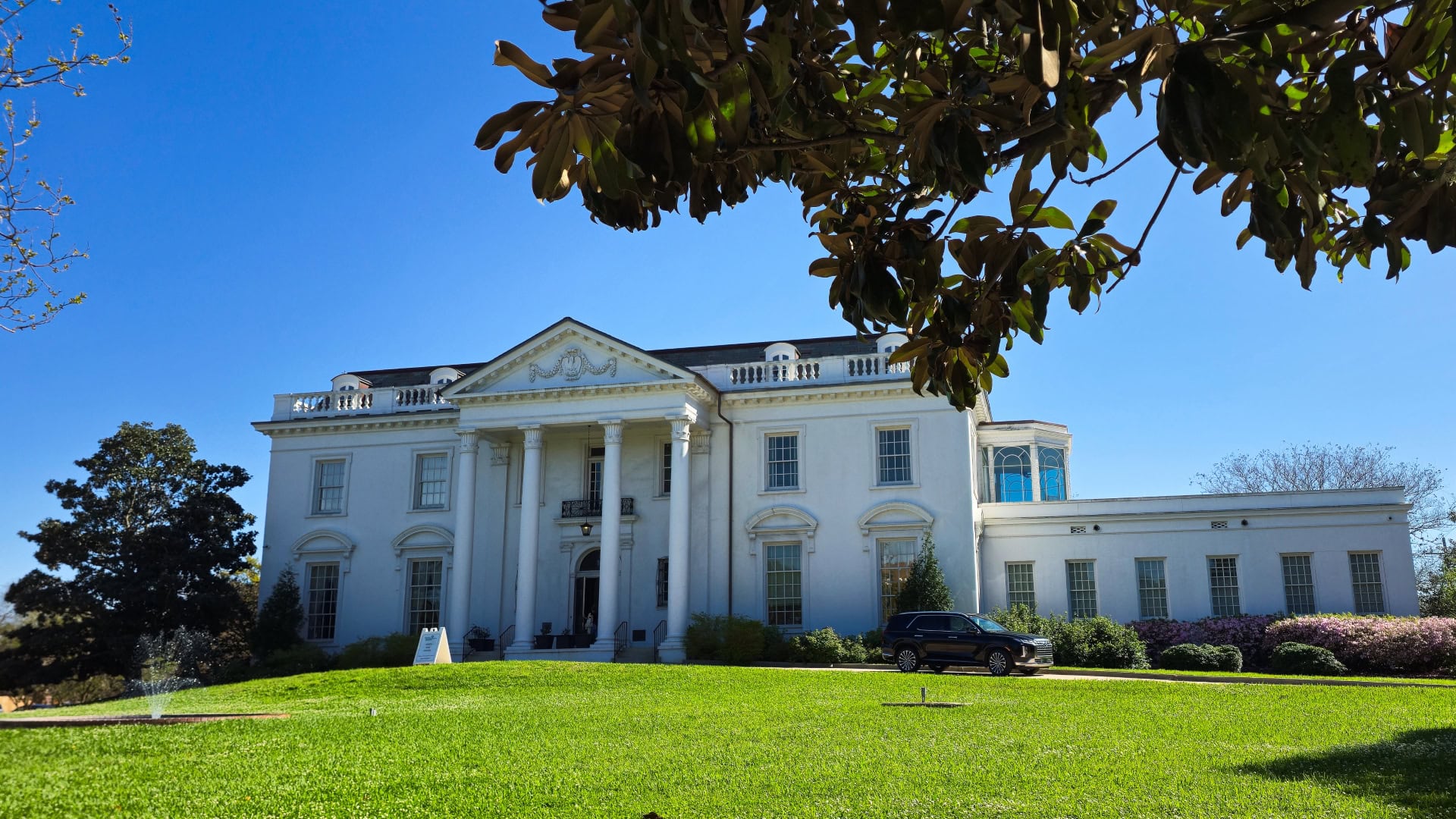
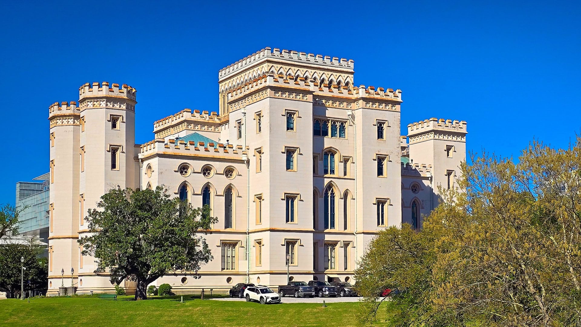
The White House in Baton Rouge, Louisiana looks a bit like the White House in Washington, DC. It is not a coincidence. The governor of Louisiana at the time (1928–1932) was Huey P. Long, and he had aspirations to become President of the United States. So, while he was governor, he had the governor’s mansion knocked down, its contents sold or destroyed, and a new governor’s residence built. Construction began in 1929 and was completed in 1930. The design closely copies the style and proportions of the White House. He did this without first getting the appropriate approvals, authority, or budget in place, so he was impeached—but not convicted. So, he got away with it… sound familiar?
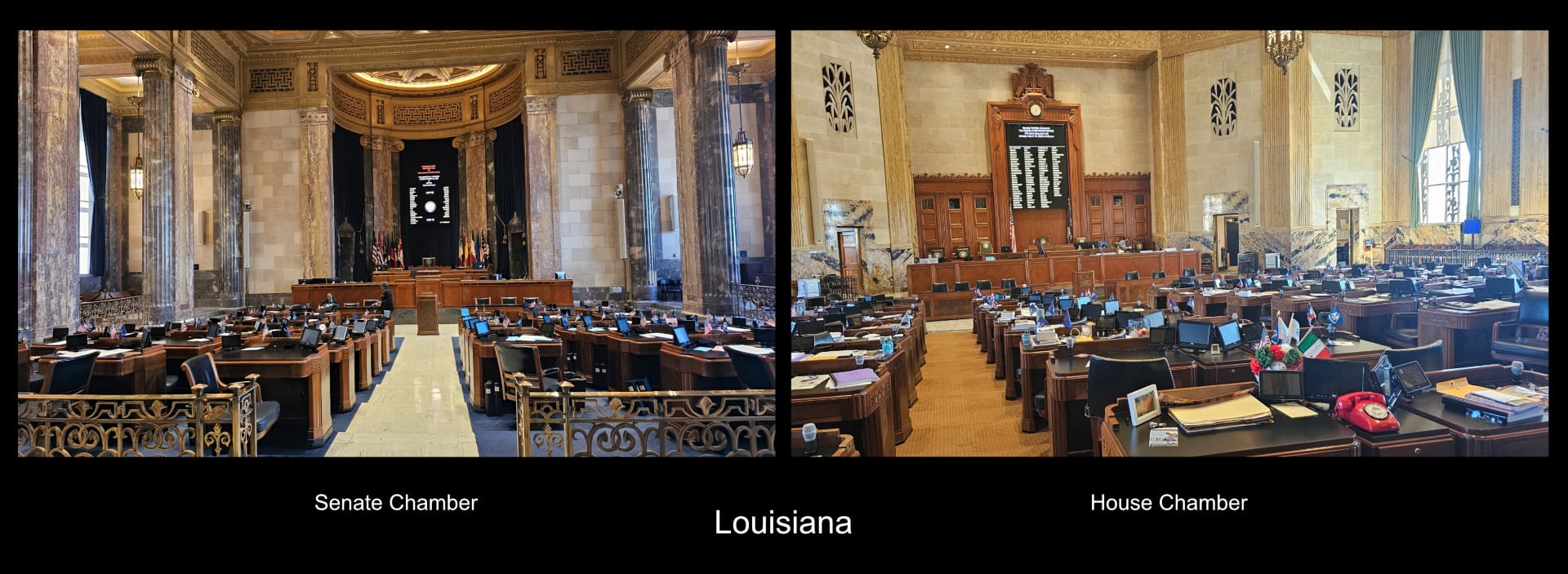
Long adopted for himself the nickname “The Kingfish.” He was one of the most powerful and controversial political figures in Louisiana history. He was assassinated in 1935 while serving as a U.S. senator, still planning to become President of the USA. The assassination took place on the ground floor of the Louisiana State Capitol building that was constructed while The Kingfish was governor. Construction of that building started in 1930 and was completed in May 1932. It is 34 stories tall, but it is currently covered with scaffolding, so we didn’t bother taking any photos of the exterior. It remains the tallest state capitol building in the USA. The building has a separate elevator for the personal use of the governor. While The Kingfish was alive, if he felt that any particular vote was “going the wrong way,” he was able to cut power to the building. That maneuver would delay the vote, giving him an opportunity to convince elected representatives to change their positions on the issue at hand.
Huey Long was motivated to have the new State Capitol building constructed because he hated the old state capitol building. The old state capitol building now serves as a museum. Ironically, many of the artifacts in the museum are devoted to the life and times of The Kingfish.
We have noted a number of differences between the USA and the rest of the world where we have been travelling. Americans act like they have never heard the term “Three R’s” for Reduce, Reuse, and Recycle:
- There are no “blue boxes.” We have previously noted that Canada lags Europe in recycling, but we have been quite surprised at the lack of recycling in the USA, where glass, plastic, and organic waste are all placed in the same bin.
- Grocery stores provide plastic single-use shopping bags. In pretty well every store we have visited, the plastic bags are so thin and weak that customers routinely double them up to carry their purchases. We continue to use our own multi-use canvas bags and occasionally receive favourable comments from cashiers.
- There is a lot of waste scattered along roadways and medians. When cycling along a well-travelled road a couple of days ago, we saw an awful lot of paper fast-food containers, plastic bottles, tin cans, and a surprising number of dead creatures, including several opossums, snakes, and even a juvenile alligator.
- On Interstate highways, you cannot travel more than a few hundred meters without seeing either the remnants of a failed tire or, in some cases, a car bumper or the carcass of a dead animal.
Near the southern end of the Mississippi River was one of the best examples of a “lazy river” creating an “oxbow lake.” An oxbow lake forms from a meander (a big bend) in a river. Here’s how it happens:
- When there is not much change in elevation, a “lazy river” naturally develops large curves as it flows.
- Over time, erosion on the outside of the bend and sediment buildup on the inside make the bend tighter.
- During a flood or high flow, the river may cut straight across the narrow neck of the bend.
- The old curved section becomes cut off from the main channel.
- The abandoned loop of water is called an oxbow lake because its shape resembles the curved wooden oxbow used in harnessing oxen.
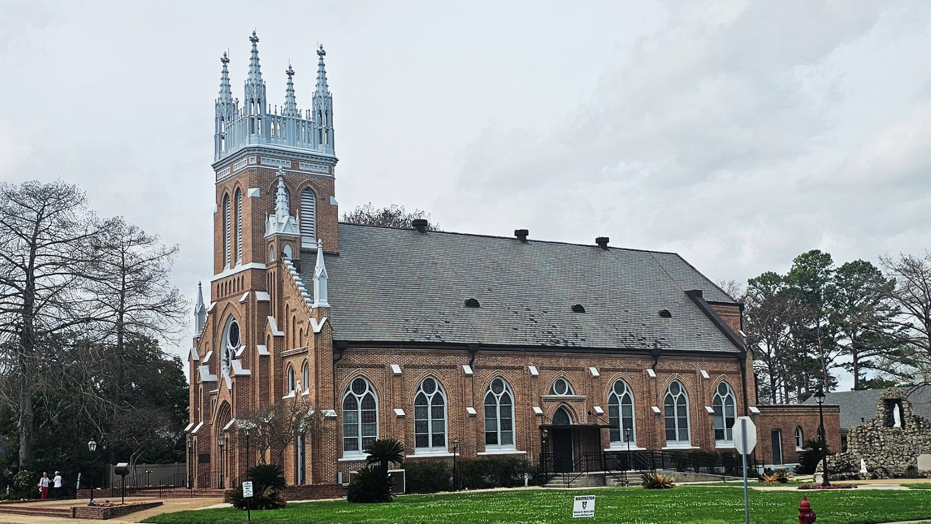
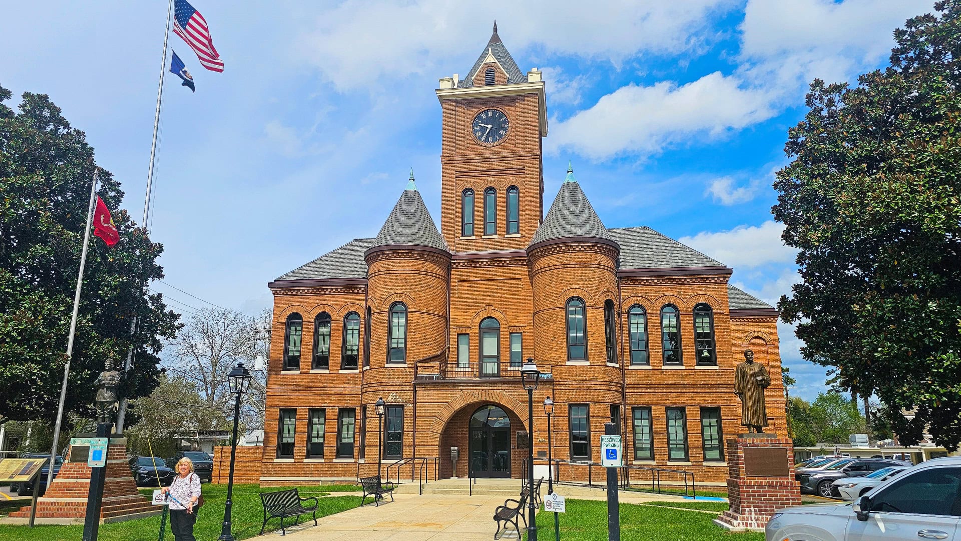
The town of New Roads, Louisiana is located on the north shore of one such oxbow lake named “False River.” New Roads is quite a picturesque, prosperous town. We parked at the recently renovated sheriff and parish clerk’s office and found the sheriff quite friendly. He spent a few minutes speaking with us and invited us to visit the building. We walked the length of the town to visit St. Mary’s of False River Church to admire the stained glass windows.
We found Houmas House Estate and Gardens about halfway along the 170 km bike route between New Orleans and Baton Rouge. Thanks to no regional trains, this ride actually took us 388 km. Houmas House was quite the find. We toured some of the grounds, which are beautifully maintained, and had a really nice lunch in the Carriage House Restaurant, surrounded by (I might say supervised by) the heads of at least 30 trophy-mounted taxidermy specimens. Many of these were clearly not indigenous to Louisiana. Jackie would have preferred a seat in one of the other rooms that had not been decorated with taxidermy.
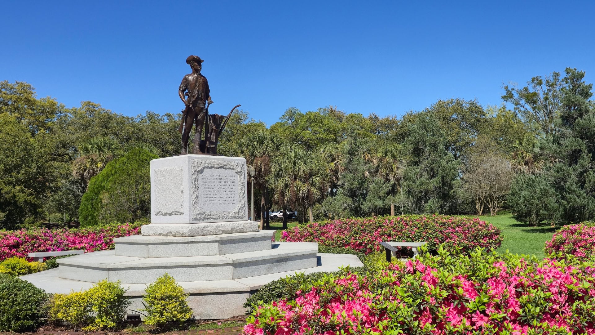
Jackie took this photo of the statue of the Minute Man which we came across during our IZI walking tour of Baton Rouge. The Minute Man is symbolic today of the Louisiana’s National Guard. While Jackie was taking the photo she stepped in a puddle while walking backwards to get the flowers in the frame. She blamed her soaked foot on the fact that we never had any children. According to Jackie, if we had had children, she would have had eyes in the back of her head and would have seen the puddle before she stepped into it.
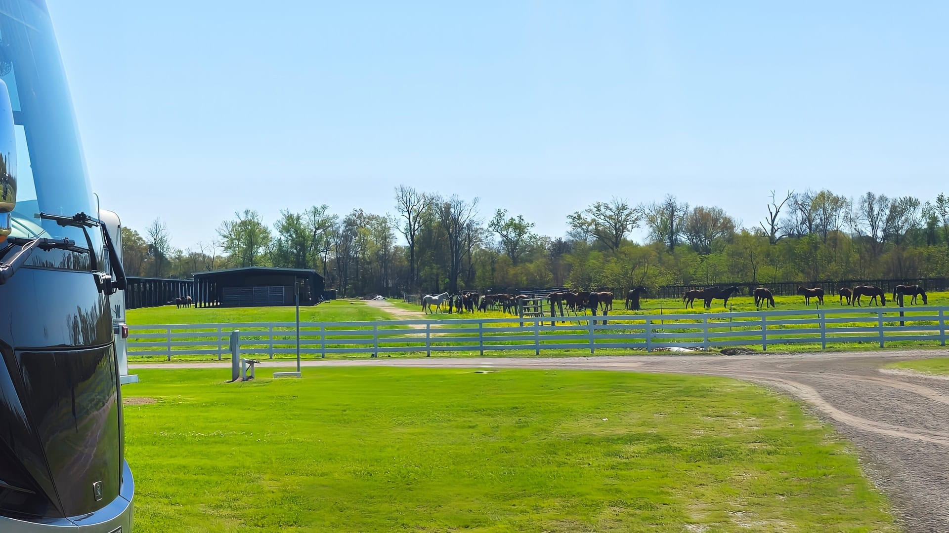
Our campground in Baton Rouge was actually an equestrian centre. We spent 8 days there, but during the second night it rained and rained. In fact, it rained so hard and so constantly that we thought we might float away. The southern half of Louisiana appears to be very flat, and much of it is sea-level swamp. There isn’t sufficient elevation change to facilitate drainage of stormwater. When we surveyed our surroundings the morning after the storm, we found that nothing untoward had actually happened. When we drove to town the next day, we were obliged to drive through a flooded section of roadway. The water in that section was at least 20 cm deep. We actually created a “bow wave” with our car that triggered the camera designed to detect objects too close to the front of the vehicle.
Now that we have moved to a campground in Texas between Houston and Galveston, we have come to understand that the southern half of Texas is similarly flat and close to sea level. In fact, much of Interstate 10 between Baton Rouge, Louisiana and Houston, Texas is built on stilts that support the highway about 3 or 4 meters above the swamp. In many places, there are “hills” in the interstate to facilitate the passage of boats beneath the highway, even though the interstate is well north of the coast.
Leave a Reply to HANS JANSEN Cancel reply