New Orleans
We have been in the New Orleans area for 2 weeks. For most of that time we have been too sick to appreciate the city. But we have more or less recovered from whatever it was that made us sick. We both went to a walk-in clinic at different times, and were tested for COVID and the flu. Those tests were negative for both of us. The clinic did prescribe a course of antibiotics for us but those antibiotics ran out, so the final stage of our recovery was more or less without any medication.
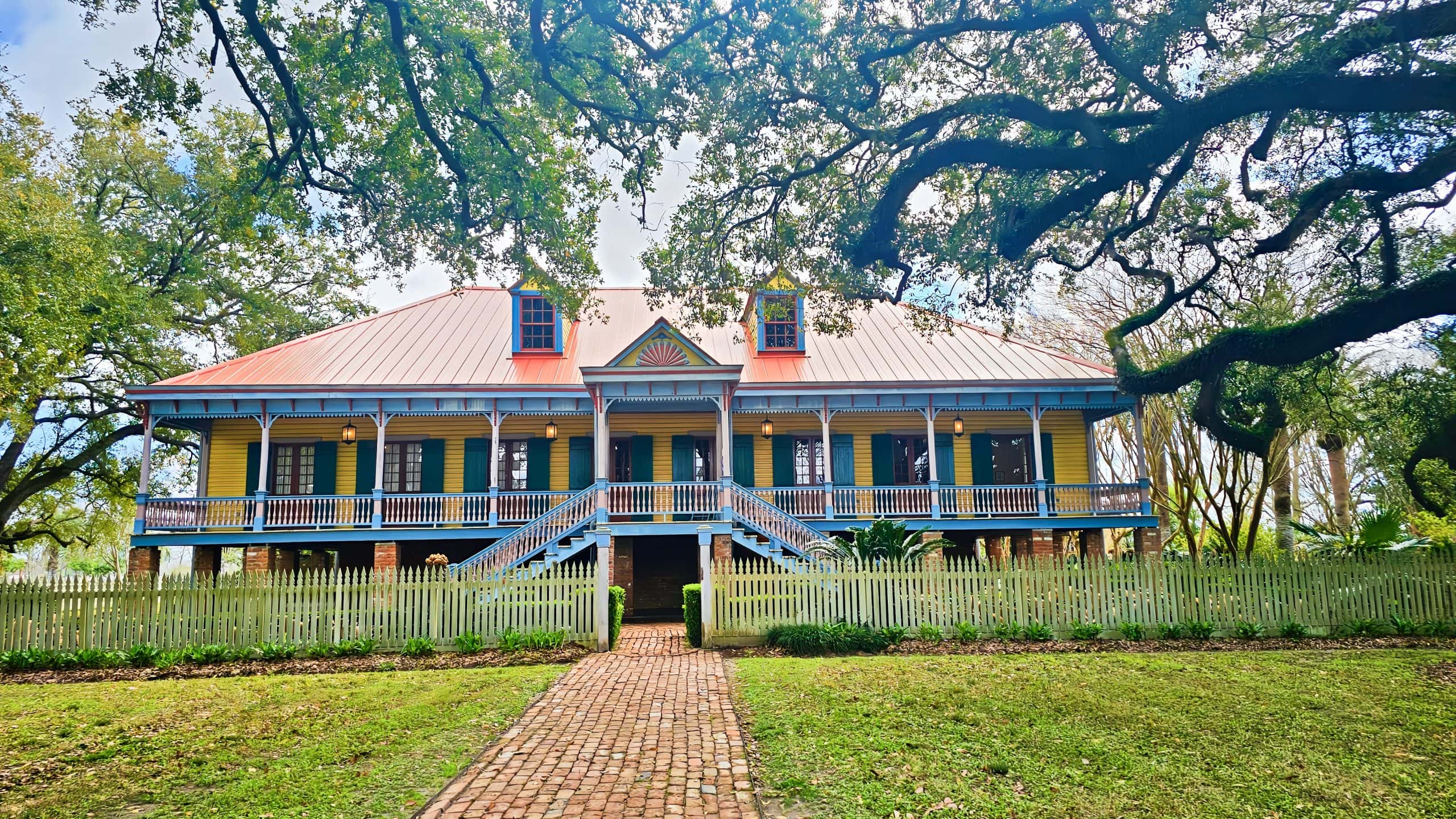
Depicted above is Laura’s Plantation family home. This was not a cotton plantation because the land is too wet for cotton. It was a sugar cane plantation and the fields around the plantation are used to grow sugar cane even now. At this time of year, the sugar cane in the fields we saw is only a few inches above the ground but by harvest time (October to December) the cane will be 3 or 4 meters tall.
Laura’s Plantation was originally established early in the 19 century well before the American civil war (1861 to 1865). Laura was a member of the 4th generation of family that owned the plantation. She sold her share of the company in 1890 when it was no longer economically viable to grow and harvest cane following the civil war (due to emancipation). Laura moved to St. Louis with her husband where she died in 1963 at 101 years old. Other 4th generation members of the family moved to France.
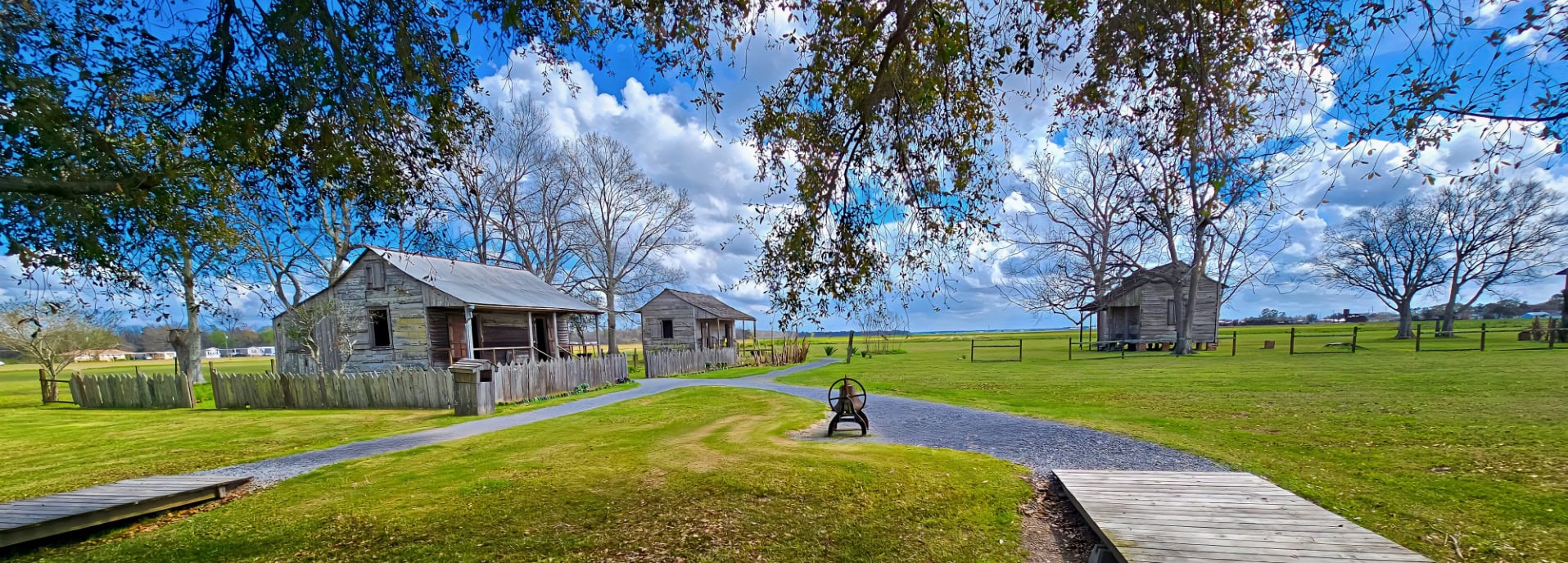
Laura’ s Plantation homestead became a museum in 1990. The museum focuses on Creole history. Our tour guide provided many insights into life on the plantation; the family that owned the plantation, the skilled slaves that built the homestead, the slaves that lived with and in the home of the owners, and the slaves that laboured in the fields. In the 19th century growing and harvesting sugar cane, boiling the cane in large cauldrons to extract and refine the sugar was very labour intensive
During the tour we leaned something that both of us found quite surprising. Namely that: The Proclamation of Emancipation, signed by Abrham Lincoln in 1863 that freed the slaves excluded areas that were already under Union control at that time. Since much of Louisiana was already under Union control, slavery continued there so that the economy would not collapse. This meant that slavery continued in Louisiana until the 13th amendment to the constitution was signed in December 1865. At that point, although slaves were “freed”, most of them continued to work under more or less the similar conditions, but now they were “paid” workers. Unfortunately, the pay took the form of wooden “tokens” that could then only be exchanged at the company store for food and rent. The tokens were useless anywhere else. Each plantation had their own currency and tokens issued at one plantation couldn’t be exchanged at any other plantation’s company store.
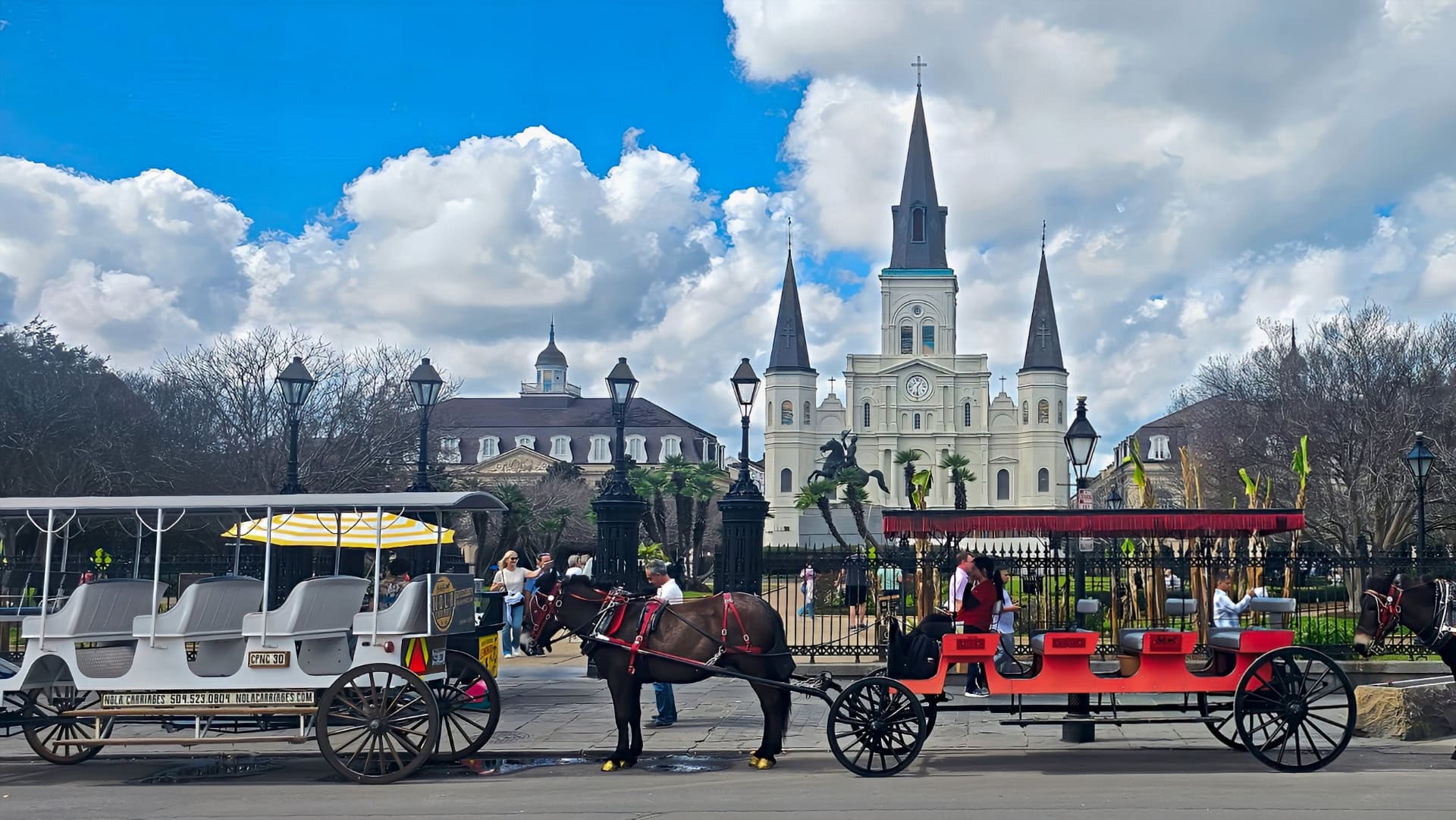
The phone app “IZI” provided us with a great walking tour of the French Quarter. We used the same ISI app extensively when we were traveling in Europe. As you get near a landmark on a prescribed route which is clearly marked on the phone, the audio kicks in and provides a description of the landmark. We especially like that IZI tours are self-paced. If we want to stop for a bit longer to read a plaque or linger over a long lunch, there’s no one to rush us along.
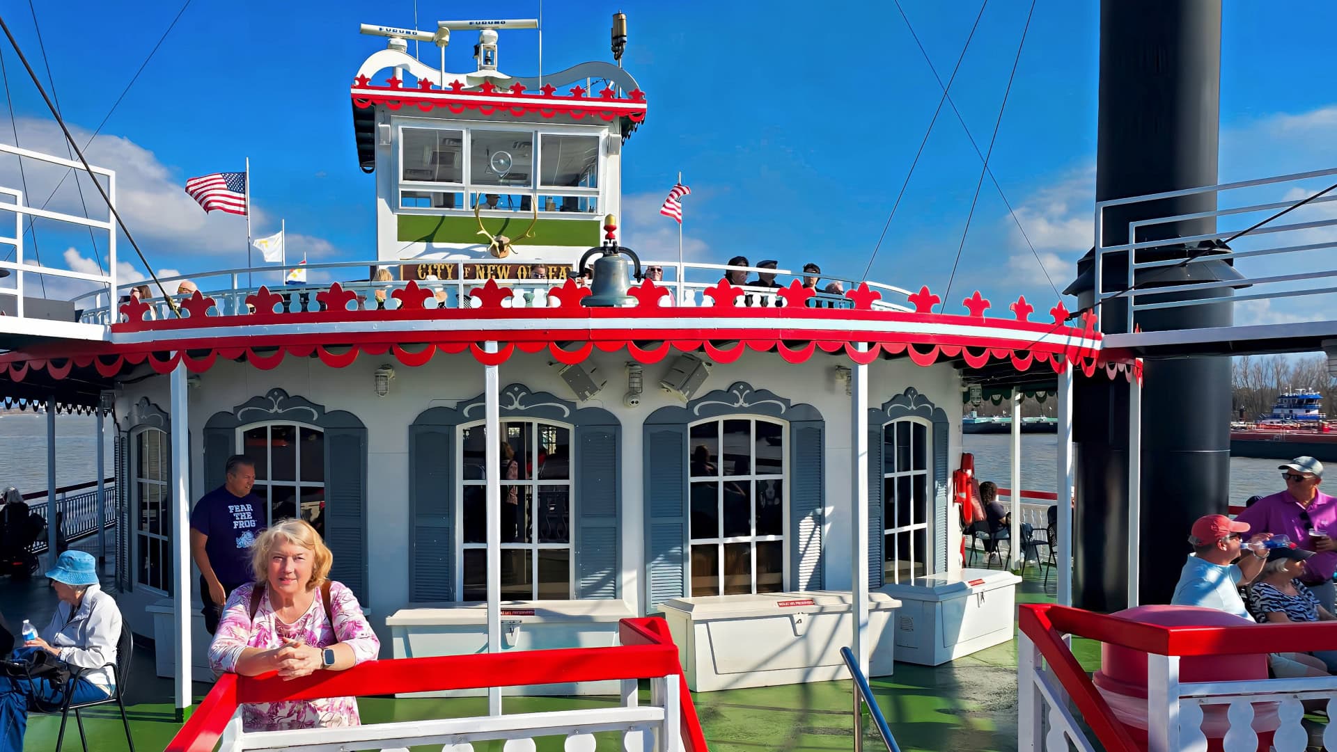
We bought tickets for a two-hour paddle boat cruise on the Mississippi. As paddle boats go, this was a really big paddle boat which had been rechristened “City of New Orleans” before it went into service providing passenger cruises on the Mississippi. The ship can safely carry 1000 passengers and is outfitted to provide a meal for up to 600 people during a two-hour voyage. The ship had been originally built in Louisiana in 1990 and had been originally christened “Casino Rock Island”. The one-armed bandits were removed and the ship was refurbished to provide passenger cruises originating from the dock next to the French Quarter in 2020. Our two-hour cruise on the City of New Orleans took us southeast of the city but not very far southeast, perhaps a distance of 15 km before returning upriver to its berth next to the French Quarter.
I always thought that New Orleans was situated at the mouth of the Mississippi river. But it isn’t so. The mouth of the Mississippi is about 150–160 km south of New Orleans. The main outlet is called Southwest Pass, one of several channels in the river’s delta. Distance by the river’s winding course from New Orleans to the Gulf of Mexico is about 153 km. In a straight line it’s somewhat shorter, but ships follow the river channel. The river spreads out into the Mississippi River Delta in the shape of a “birds-foot” with several access routes into the Gulf. Ocean-going ships traveling to New Orleans must navigate this entire stretch from the Gulf up the river.
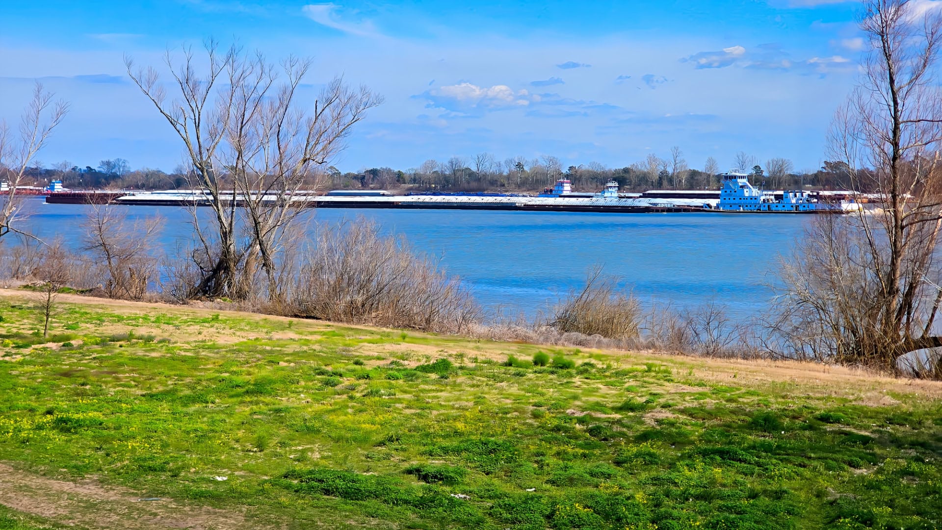
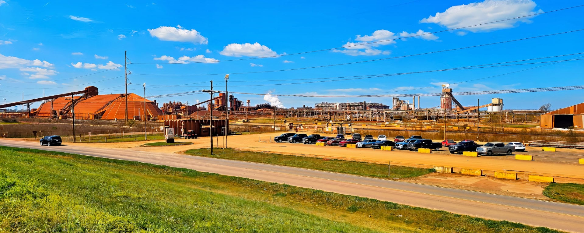
Although Jackie didn’t feel up to it, I did get to ride my bike along the Mississippi for much the way to Batton Rouge. Most of the time I rode on top of the levy, so I had a great view of both the Mississippi and the industrial developments including quite a few refineries that utilize their proximity to the river for economic transport. I will probably complete the distance to Batton Rouge when we move our motorhome to a campground near Batton Rouge.
Leave a Reply