The Durmitor Ring
The panoramic Durmitor Ring, what a spectacular route. Montenegro’s Tourist Department has identified five “panoramic” routes throughout the country. They are slowly putting up road signs for all of them. They have also taken great advantage of the izi.Travel app that Mike and I use a lot. izi.Travel is the app that has audio tours of cities that you can download and then, as you walk past a point in the tour, your phone automatically starts talking to you and describing what you are looking at. Two of the five panoramic routes have been completed by the tourist department with the other three in process. They have roads signs directing you around the routes and both also have izi.Travel audio tours. We hooked up our cell phones to the car’s audio system and as we drove past certain spots on the road, we would hear various details. Sometimes we heard about exactly what we were seeing, at other times we heard short interviews with locals, occasionally we heard legends about different mountains and lakes. It was very interesting and extremely well done. We have had a lot of rain while we have been in Montenegro so neither of the two tours that we took were in the best weather. We also saw quite a bit of the other panoramic routes as we explored Montenegro on our own. The first proper tour was a panoramic route near the capital city Podgorica. Later we moved our camper further north to where the higher mountains are. We camped one hour south of the start of the Durmitor Ring route.
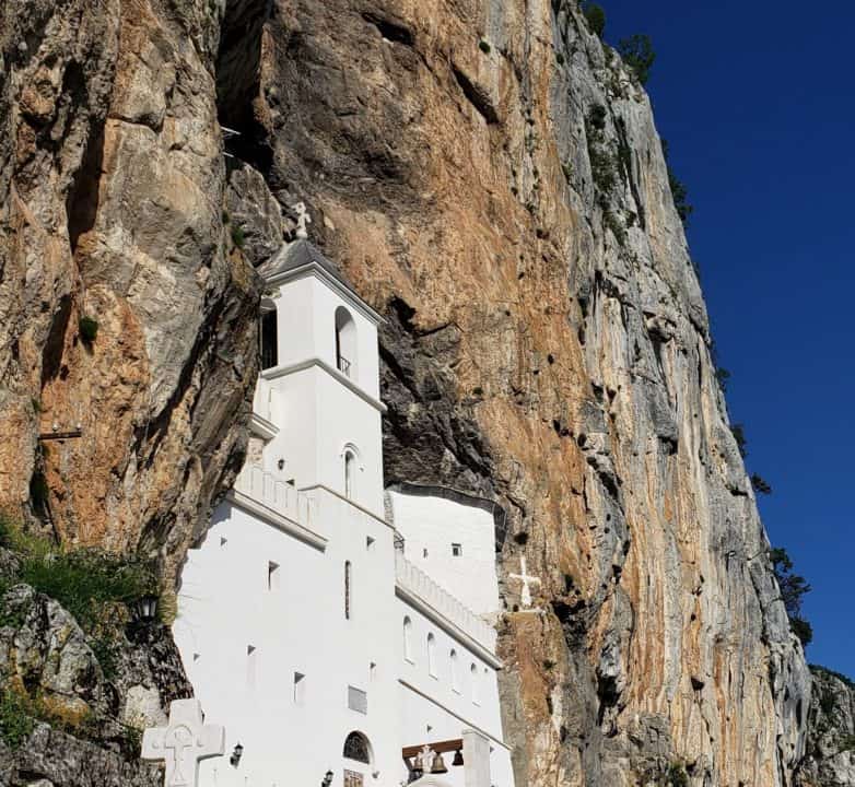
When we were looking for a campground in this area, we happened to pass by a tourist/pilgrimage site that we had previously seen pictures of. This was the Ostrog Monastery which is carved right into the side of the mountain. It can be seen for miles from below as the white of the monastery really stands out against the rocks. We should have said that we were handicapped. The parking lot was a long way below the monastery.
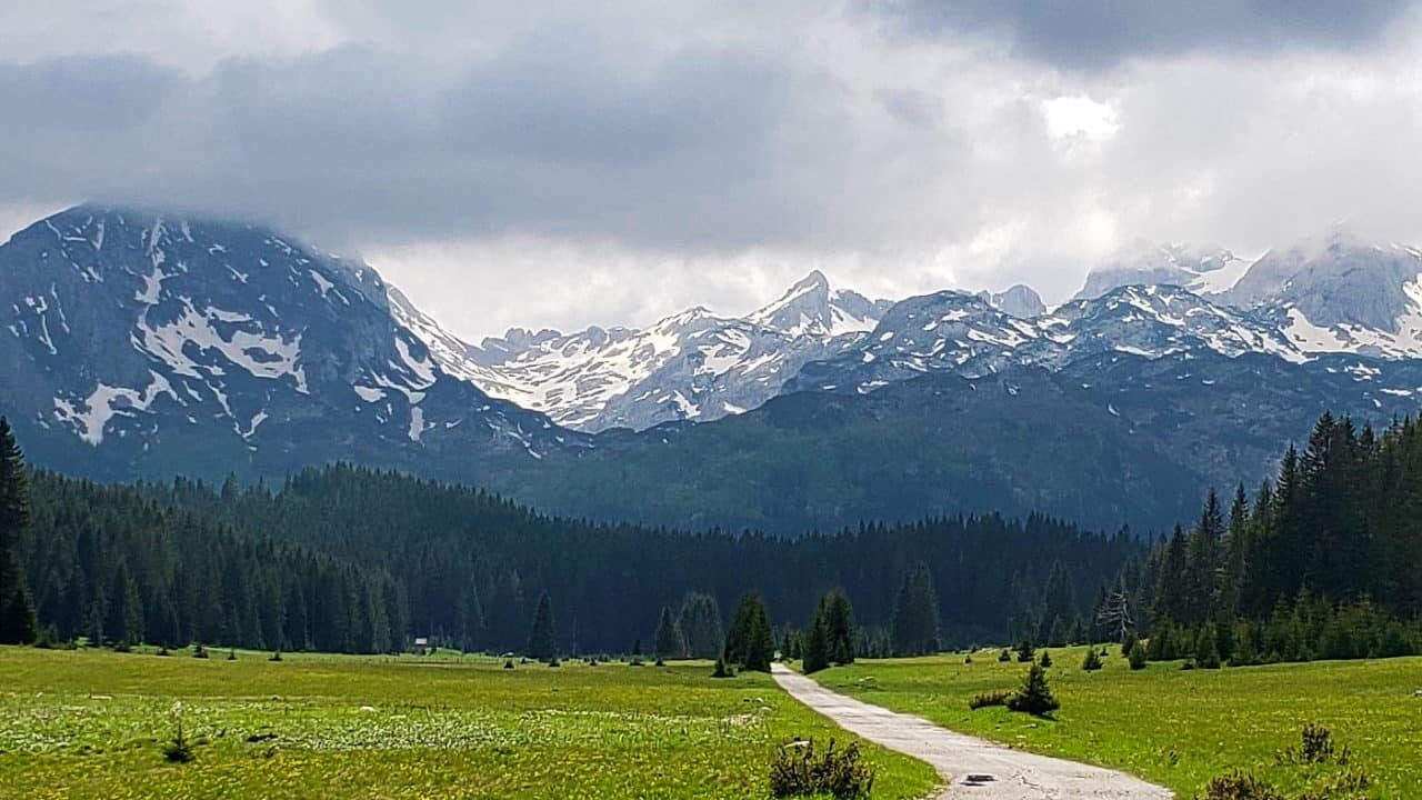
Durmitor National Park is in northwestern Montenegro. The mountains are part of the Dinaric Alps and have 48 peaks above 2000 metres or 6500 feet. The deepest point of the 82 km Tara River Canyon is 1300 metres (over 4000 feet) making it the deepest gorge in Europe. The only deeper canyon in the world is the Grand Canyon in the United States which is only 200 metres deeper.
Mike and I drove north and started the tour. We got as far as stop 3 (out of 54) in the tour when we took an optional side trip. We ended up in a parking lot where a hike to the summit of Mt Ćurevac started. Mt Ćurevac is 1625 metres or >5,000 ft high. Obviously, we didn’t start from the bottom! Our intent was to do this “easy” hike and then continue on with the car tour. We must be much slower than other hikers because it took us a lot longer than anticipated. Coming back, it started drizzling a little and the rocks got quite slippery which was uncomfortable. The views from the hiking trail were just spectacular. We haven’t done as much hiking this year as I would like. I haven’t properly broken in my new hiking boots yet.
On our way down the mountain we met a group of 14 people from France, all on a hiking vacation. I think that Europeans are much more fit in their later years than Canadians and Americans. At home the average age of a hiking group would probably be 25 – 35 years old. This group averaged in their fifties, with a range from a few in their thirties to some quite a bit older than Mike and I. Mike and I have commented before on the average age of many of the active people we see over here.
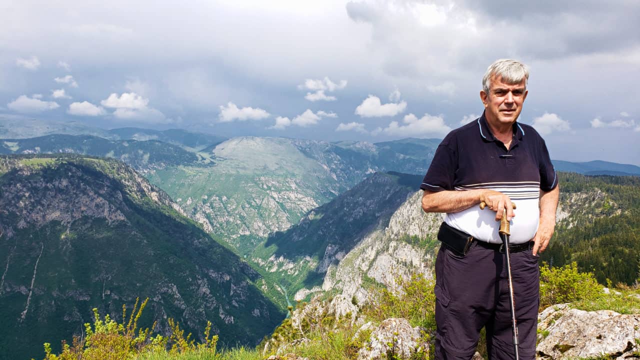
The views from the summit were outstanding, even on an overcast day. By the time we finally made it down off the mountain and back to the car it was raining so we called it quits for the day and headed back to our camper.
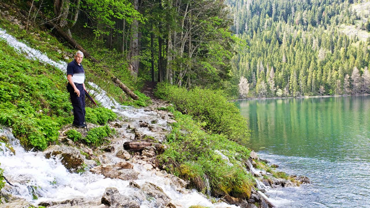
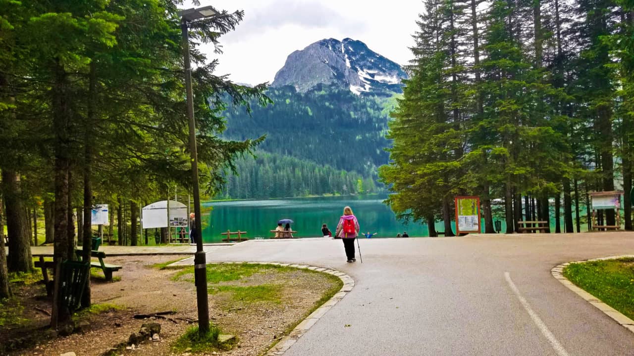
Two days later we tried again. This time the plan was to have lunch in the town at the start of the tour and do an “easy” hike around a glacial lake and then continue with the car audio tour. There are 18 glacial lakes in the Durmitor range. They are known as “Mountain Eyes” which I think sounds nice. We planned on walking the trail around Black Lake which is actually two smaller lakes: Big Lake and Little Lake. The lakes are connected by a narrow strait that dries up during the summer. The lake made both Mike and me instantly think of Canada’s Lake Louise when we first saw it. It had the gorgeous turquoise colour that you find in the some of the lakes around Banff. Mike found it really interesting that the water would flow in two different directions at different times of the year. In the spring, with all the mountain runoff, Little Lake fills and flows into Big Lake with the outflow going into the Tara river. Later in the year, with less water from the mountains, the flow reverses with Big Lake flowing into Little Lake and the outflow going to a different river on the other side. Apparently, this is extremely unusual.
As I said, Mike and I started walking the 3.5 km walking path around the lakes. We ran into a few problems. It was drizzling on and off which was causing the path to be very muddy in spots. We saw one sign that had a second path going uphill. We couldn’t read it, so we ignored it. That might have been a mistake. We came to some small waterfalls that, due to the recent rains, were flowing quite heavily over the path. As you can see below, with some very careful balancing on the rocks, we crossed the first waterfall, then a bit later we crossed a second waterfall, then we crossed a third waterfall flowing over the path. By this time our pants were somewhat wet. When we came to the fourth waterfall, it was the highest and had the most water pressure of them all. It is possible that we could have crossed it successfully, but I had two concerns. First was the very expensive phone in my back pocket that I didn’t want to land on in water and rocks. Second, we still had a 4-hour panoramic route to drive when we finished this hike. I was not looking forward to either of us falling down and getting soaked or hurt. Since our plan had been to have a nice walk around the lake and we had made it halfway, we still ended up with a walk of the same distance when we turned back. Afterwards, I read on the internet a description of this path: “Cascades up to 15 meters high flood the path. The sight is unforgettable, and the braver visitors walk through the foamy curtain.”. I guess we weren’t among the braver visitors. Our walk again took us considerably longer than we had anticipated. I was started to wonder about our hiking speed until I read someone else on the internet saying that after trying this easy route, he wasn’t trying anything marked medium!
We left the lakes and finally got started properly on driving around the Durmitor Ring. The route is only 85 km long, but they suggest that you allocate 4 hours. Does that tell you the type of roads that you will be driving on! The route goes along the peaks of the mountain range, which rise above 2,000 meters (6500 feet) high. It goes through high mountain passages and down through some of the canyons. Even in the drizzle, with limited visibility, it was magnificent. You often drive past snow on the side of the road. At one point we drove up into the clouds. It was really interesting watching the mountains in front of us slowly disappear as we wondered if the little road (track?) we were on was going to disappear also.
Most of the route is one lane wide but with two-way traffic. You would think that we would be used to that by now. The one lane is so narrow that it is difficult to pass a bicycle without leaving the paved roadway with the left side of the car. When you meet an oncoming vehicle, usually near a blind curve, there is an immediate adrenaline rush. Once both vehicles come to a panic stop, someone (either you or the other driver) needs to get their vehicle off the road. Since much of the road is a mountain track (rock wall on one side and gorge on the other), it is usually necessary for one of the vehicles to back up to a spot where there is a bit of a shoulder at the edge. This can be a little nerve wracking.
I have to give full credit to Montenegro’s tourist department for putting the audio to these road tours. It worked extremely well. I hope they get the same audio made for the other three panoramic routes. At one point on the audio, they were interviewing a local retired man who had returned to the area. In the middle of the conversation, he happened to mention that his monthly pension was 120 Euros which is $180 Canadian per month. Not much to live on. They say that Montenegro is very inexpensive but that really depends on where you are. In the tourist areas along the coast, prices aren’t high, but they aren’t inexpensive either. Prices for almost everything drop somewhat as you get further from the Adriatic coast and closer to the capital city and into Central Montenegro. The further north you go the more the prices drop until it really is inexpensive compared to what we are used to. I had a lovely chicken and mushroom penne dish. It was 490 grams or 16 oz and fed me for three meals. It cost us less than $5 Canadian. More impressive than the inexpensive food though is the fantastic free scenery.
Leave a Reply